MRCagney's data science team distills data into insights on how our cities change.
Here is a portfolio of our analyses and visualisations for your perusal.
If you would like help with your data, email us.
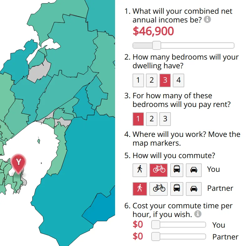
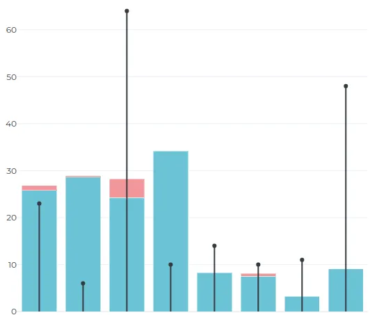
Affordability in New Zealand
A visualisation of housing affordability in various regions of New Zealand
More info
Try it!
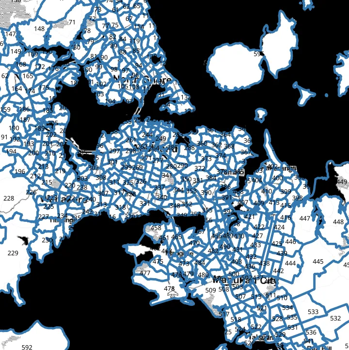
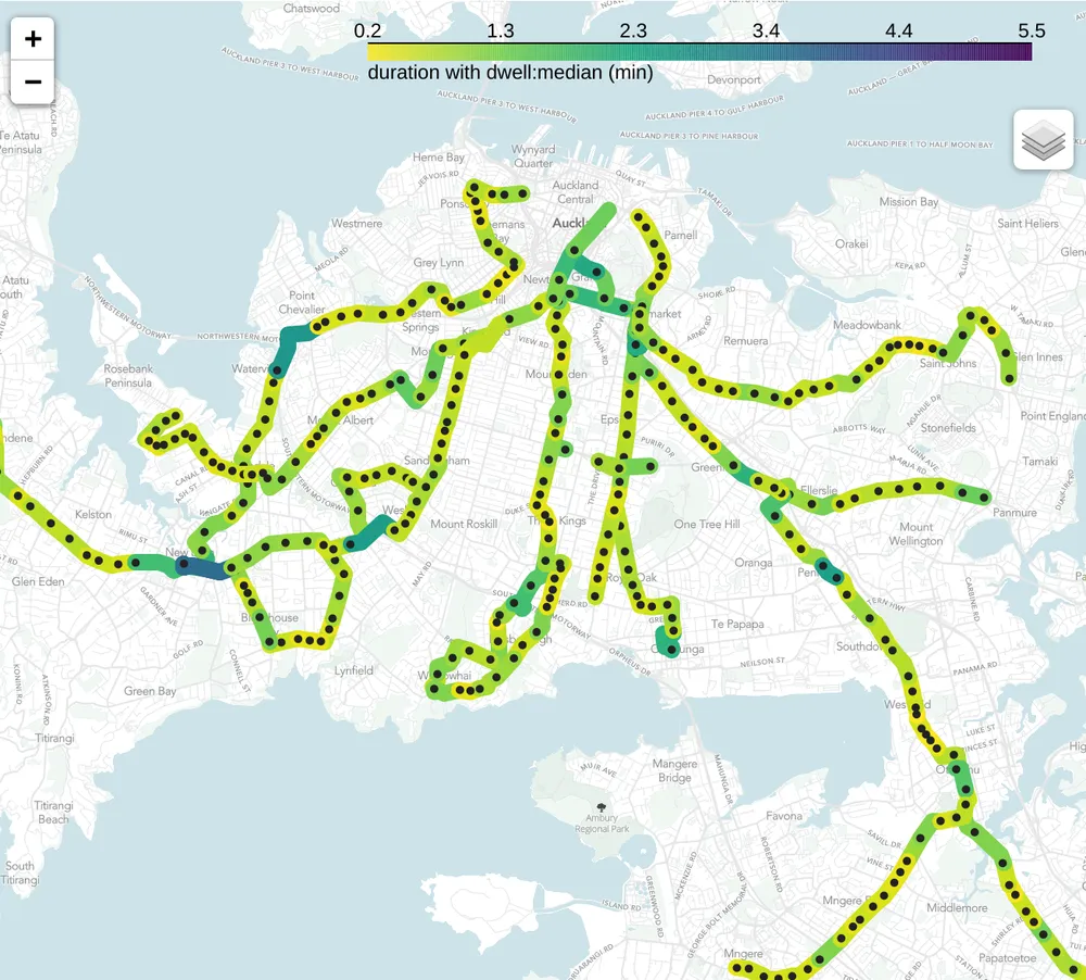
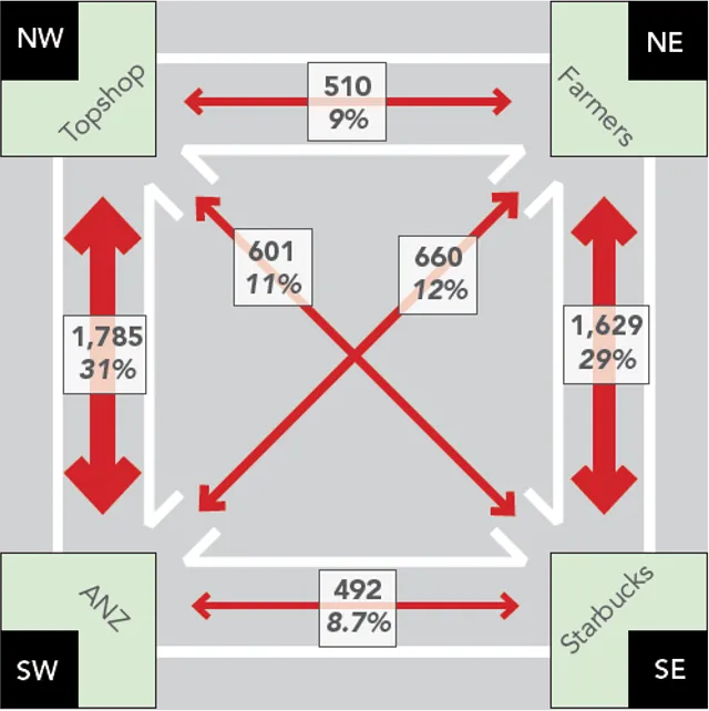
AT Transit Flows
A visualisation of vehicle flows through Auckland's current and future transit networks
More info
Try it!
Auckland Transport Model Kit
A software package to compute economic benefits from Auckland's transport model outputs
More info
Auckland Walking and Cycling Counts
A visualisation of Auckland's walking and cycling counter data
More info
Try it!
B Corper
A visualisation of all certified B Corporations in the world
More info
Try it!
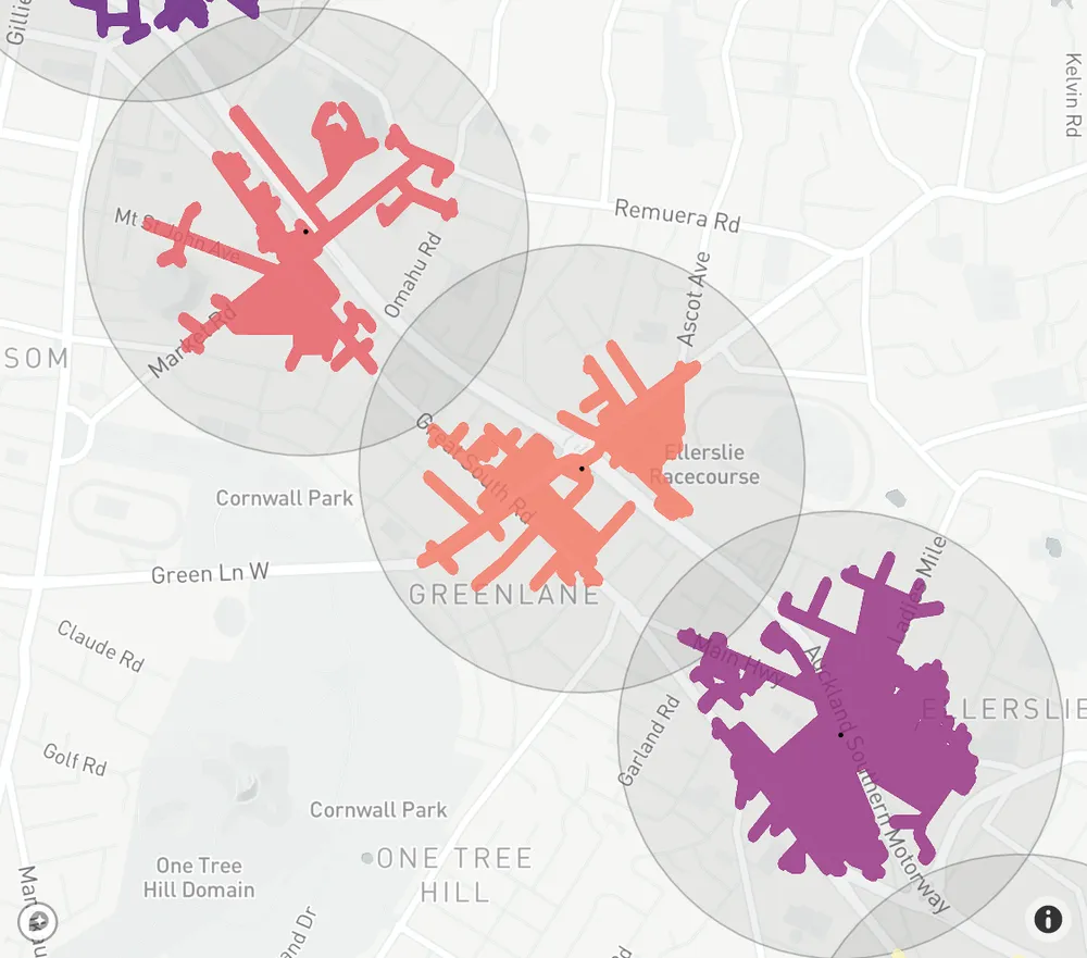
Catchies
A visualisation of walking catchments around busway, train, and ferry stations in Auckland
More info
Try it!
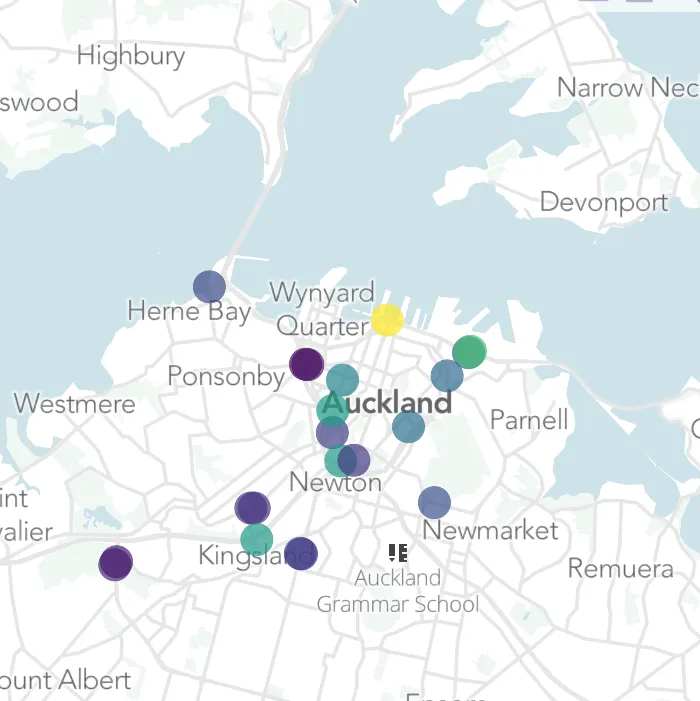
Connected Communities
Analysing and visualising central Auckland's public transport corridors
More info
Try it!
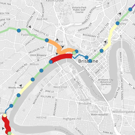
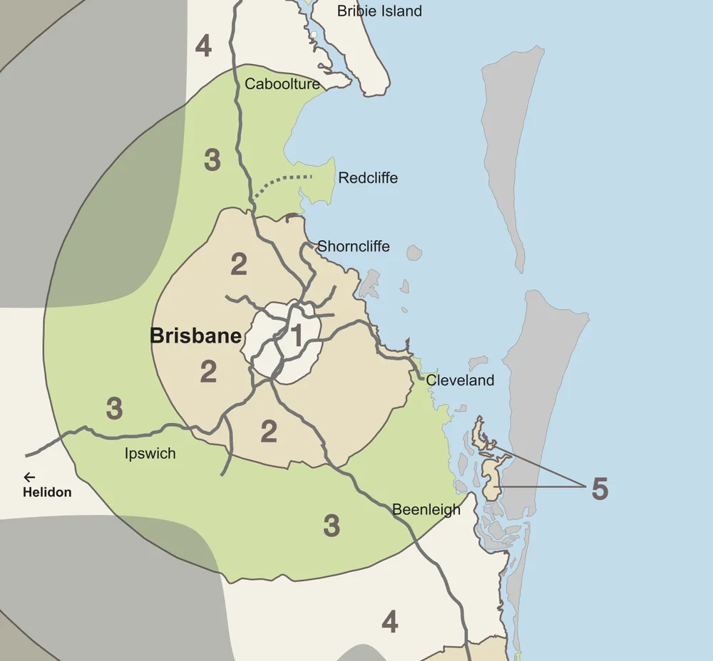
Corridor Explorer
A web application to analyse and visualise key corridors in South East Queensland's public transport network
More info
E-Scooter Analysis
A toolkit to analyse and visualise rental e-scooter trips in Auckland
More info
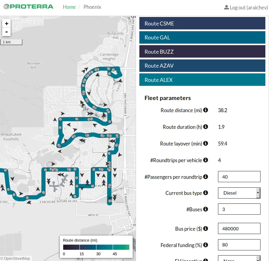
EV Simulator
A web application for Proterra, the electric bus manufacturer
More info
GTFS Explorer
A web application analysing and visualising public transport networks
More info
Try it!
GTFS Kit
An open-source software package for analysing General Transit Feed Specification (GTFS) data
More info
Try it!
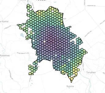
Job Accessibility
A data story of access to jobs in Hamilton, New Zealand
More info
MRCagney Reports
Interactive reports on MRCagney's projects, staff, and company
More info
Try it!
New Zealand Land Value Model
A software package to model New Zealand land value differences across planning zone boundaries
More info
South East Queensland Fare Study
A fare and ridership model of South East Queensland's public transport network
More info
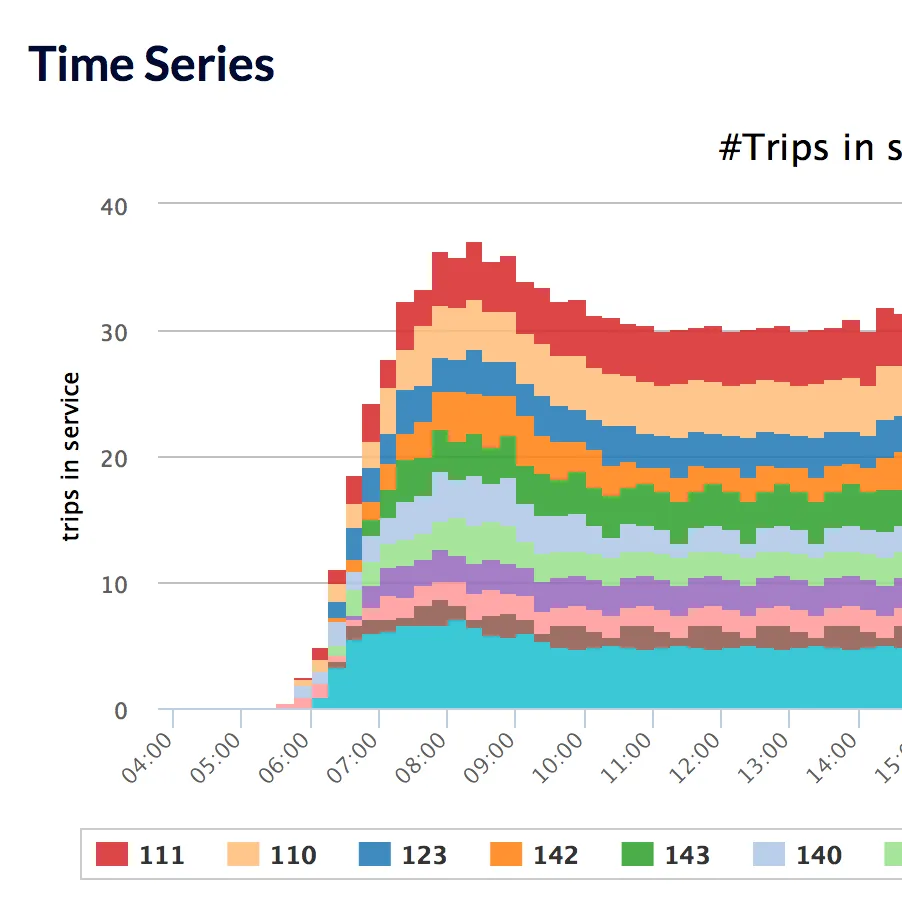
Transit Flows
A visualisation of public transport vehicle and passenger flows
More info
Try it!
Transit Stops
A visualisation of public transport passenger boardings and alightings
More info
Try it!
Transport 2030
How changing Auckland's transport network can reduce its carbon emissions
More info
Try it!
Valuing Pedestrians
A process for estimating the value of delays to pedestrians at busy, city centre intersections.
More info
Wavetrace
An open-source software package to model radio signal propagation
More info
Try it!
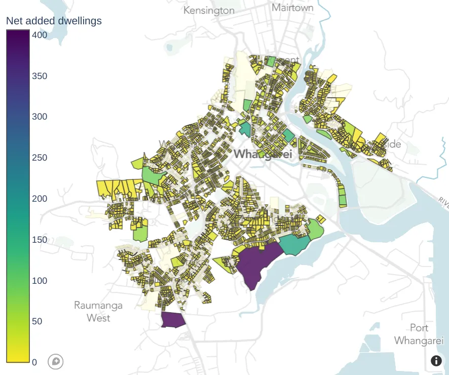
Whangarei Housing Assessment
Analysing and visualising housing capacity in Whangarei
More info
Try it!